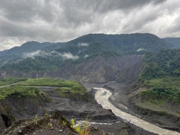
ORNL drone and geospatial team becomes first to map the Coca River in the Amazon basin as erosion and sediment threaten Ecuador’s lands.
ORNL drone and geospatial team becomes first to map the Coca River in the Amazon basin as erosion and sediment threaten Ecuador’s lands.