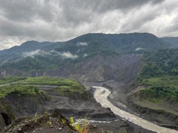
ORNL drone and geospatial team becomes first to map the Coca River in the Amazon basin as erosion and sediment threaten Ecuador’s lands.
ORNL drone and geospatial team becomes first to map the Coca River in the Amazon basin as erosion and sediment threaten Ecuador’s lands.

Researchers at ORNL are using a machine-learning model to answer ‘what if’ questions stemming from major events that impact large numbers of people.

ORNL’s Assaf Anyamba has spent his career using satellite images to determine where extreme weather may lead to vector-borne disease outbreaks. His work has helped the U.S.
ORNL took home the top honors in three categories at the second annual DOE Geospatial Science Poster competition, held on National GIS Day. For the second year in a row, DOE awarded ORNL top prize as Best Geospatial Program.
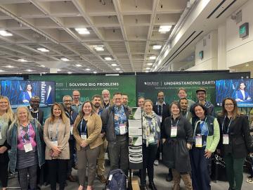
ORNL scientists and researchers attended the annual American Geophysical Union meeting and came away inspired for the year ahead in geospatial, earth and climate science.
Jack Orebaugh, a forensic anthropology major at the University of Tennessee, Knoxville, has a big heart for families with missing loved ones.
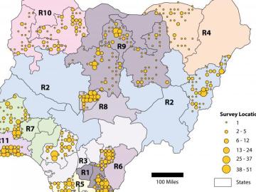
Oak Ridge National Laboratory scientists helped count the population of Nigeria – all without leaving the lab.
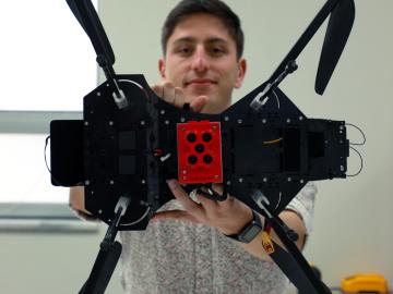
Horizon31, LLC has exclusively licensed a novel communication system that allows users to reliably operate unmanned vehicles such as drones from anywhere in the world using only an internet connection.
Each summer for the last 30 years, students and teachers from across Appalachia have travelled to ORNL for a unique STEM summer camp experience – the Appalachian Regional Commission/ORNL Science-Technology-Mathematics Institute.
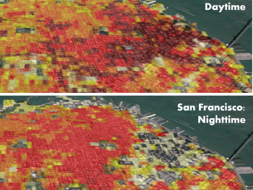
Oak Ridge National Laboratory’s high-resolution population distribution database, LandScan USA, became permanently available to researchers in time to aid the response to the novel coronavirus pandemic.