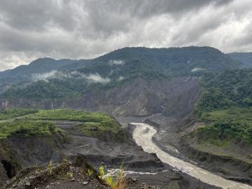
ORNL drone and geospatial team becomes first to map the Coca River in the Amazon basin as erosion and sediment threaten Ecuador’s lands.
ORNL drone and geospatial team becomes first to map the Coca River in the Amazon basin as erosion and sediment threaten Ecuador’s lands.

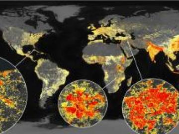
Researchers at ORNL are using a machine-learning model to answer ‘what if’ questions stemming from major events that impact large numbers of people.

ORNL’s Assaf Anyamba has spent his career using satellite images to determine where extreme weather may lead to vector-borne disease outbreaks. His work has helped the U.S.
ORNL took home the top honors in three categories at the second annual DOE Geospatial Science Poster competition, held on National GIS Day. For the second year in a row, DOE awarded ORNL top prize as Best Geospatial Program.
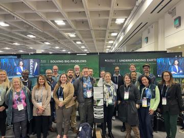
ORNL scientists and researchers attended the annual American Geophysical Union meeting and came away inspired for the year ahead in geospatial, earth and climate science.
Jack Orebaugh, a forensic anthropology major at the University of Tennessee, Knoxville, has a big heart for families with missing loved ones.
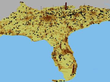
Using novel data sets and computing systems, researchers at ORNL are simulating how climate change affects the safety and security of the country.
Research teams from the Department of Energy’s Oak Ridge National Laboratory and their technologies have received seven 2021 R&D 100 Awards, plus special recognition for a COVID-19-related project.

A team of scientists led by ORNL’s Gautam Thakur has developed a new scientific method to screen human data annotators for bias, ensuring high-quality data inputs for machine learning tasks.
An analysis published in the Proceedings of the National Academy of Sciences and led by researchers from the U.S.