Developing AI tools for Geospatial Intelligence
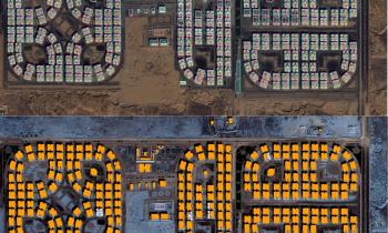
Through advances in artificial intelligence, Oak Ridge National Laboratory is transforming geospatial analytic methods in support of information exploitation and dissemination into geospatial intelligence (GEOINT) foundational data layers. We apply GeoAI methods to address several national security applications including infrastructure mapping, change detection, damage assessment, socioeconomic analysis, population dynamics, geomatics, maritime safety, geospatial data privacy and trustworthiness of AI systems.
With core strengths in machine learning for high-performance computing, geoassurance, probabilistic reasoning, and spatio-temporal analytics, we are forming alliances and collaborating to support geospatial science and human security missions.
GeoAI Workshops and Events
The annual Trillion Pixel Challenge workshop is an opportunity to foster collaboration, share insights and best practices, and ensure scientific robustness and operational utility. The 2024 workshop, co-hosted with NASA, focused on the intersection of AI foundation models and geospatial digital twins, which are virtual replicas of the physical world. Experts gathered to discuss the integration and challenges of employing AI in digital twins in topics such as data integration, enhancing analytical and predictive analysis for future scenarios, and improving decision-making.
This annual, one-day workshop at the ACM Sigspatial Conference includes keynotes, individual presentations, and paper presentation awards. The event focuses on AI for geographic knowledge discovery, impacting decision-making in areas such as humanitarian mapping, intelligent transport systems, urban expansion analysis, health data analysis and epidemiology, handling natural disasters, and the general monitoring of the Earth’s surface.
We organize the Computer Vision for Earth Observation workshop series at the annual IEEE/CVF Winter Conference on Applications of Computer Vision, fostering application-oriented discussions between the computer vision community and experts from geoscience domains, remote sensing data providers, governmental agencies, and other organizations utilizing computer vision-enabled EO data analysis for decision-making in disaster response, national security, environmental protection, and other application areas.
We're a multidisciplinary team
To deliver our mission, we need dedicated, mission-driven researchers with expertise in electrical engineering, applied mathematics, computer engineering, statistics, computer science, data science, and more!
In addition to these academic backgrounds, our team has expertise in Artificial Intelligence, Probabilistic Reasoning, Computer Vision, Risk Analysis, Visual Analytics, High-Performance Computing, Geographic Information Science, Ontology Reasoning, and Remote Sensing.
Exploring complex geospatial analytic workflows

Settlement Characterization

AI-Driven Data Flows

Mapping Building Footprints, Road Networks, and More

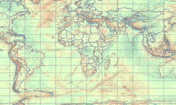
Gravity Mapping
Keeping people safe
Our deep-learning methods underlie a critical geographic dataset used during hurricane response efforts
ORNL tools help ensure energy supply
ORNL researchers developed a mobile system to quickly detect objects and analyze images following disasters


