-
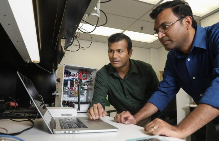
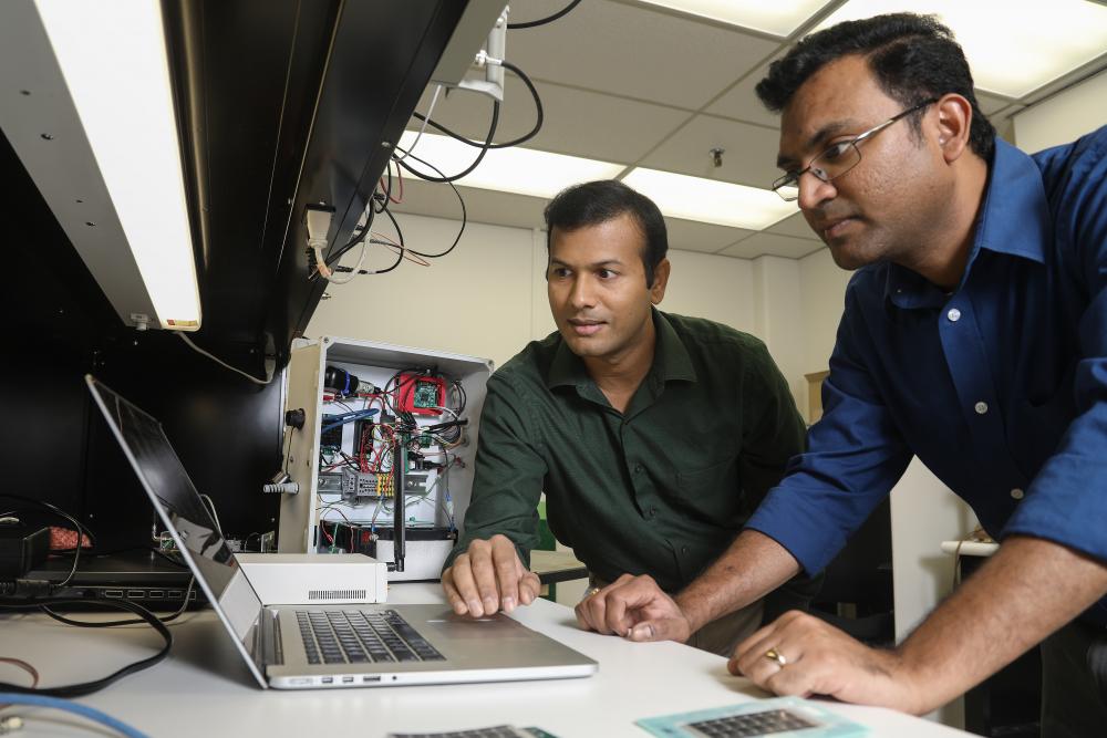
Gautam Thakur, left, and Teja Kuruganti demonstrate UrbanSense, a novel sensor network aimed at helping cities manage their growth
and evaluate future development opportunities. Image credit: Jason Richards, ORNL -
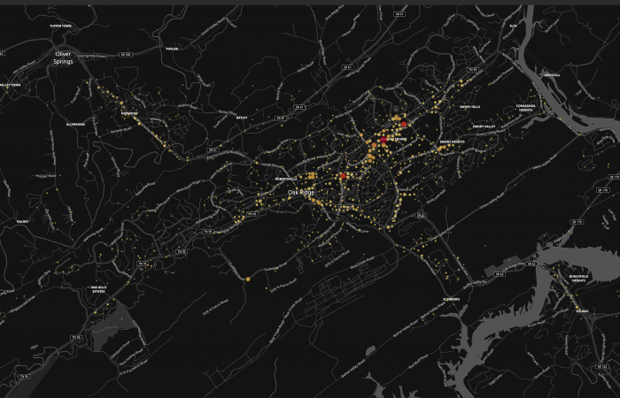
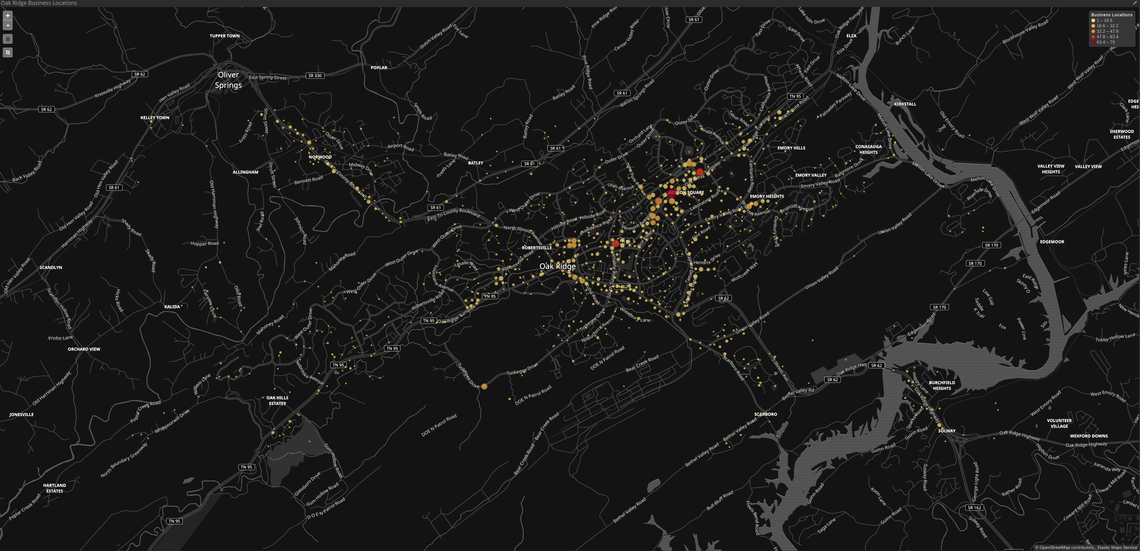
UrbanSense passively collects anonymous, open-source data from cellular towers and other sources to generate real-time estimates of population density in cities. Insights on how people interact with urban infrastructure help cities like Oak Ridge, Tennessee (below), assess their needs and plan effectively for future development. Image credit: Gautam Thakur, ORNL
-
Gautam Thakur, left, and Teja Kuruganti demonstrate UrbanSense, a novel sensor network aimed at helping cities manage their growth
and evaluate future development opportunities. Image credit: Jason Richards, ORNL -
UrbanSense passively collects anonymous, open-source data from cellular towers and other sources to generate real-time estimates of population density in cities. Insights on how people interact with urban infrastructure help cities like Oak Ridge, Tennessee (below), assess their needs and plan effectively for future development. Image credit: Gautam Thakur, ORNL
ORNL’s Urban Dynamics Institute is working with the city of Oak Ridge to develop a sensor network and web tool that will evaluate trends in urban activity and help cities plan their development more effectively.
The technology, called UrbanSense, shows how a community is being used, not just where people live and work, say UDI researchers Teja Kuruganti and Gautam Thakur from ORNL’s Computer Science and Engineering Division.
“We are using sensors to generate observations and insights to help cities measure their growth and success,” Kuruganti said. “We want to give cities like Oak Ridge a better sense of their population distribution and dynamics.”
Kuruganti and Thakur are collaborating with Oak Ridge’s director of administrative services, Bruce Applegate, on the design and deployment of the system.
UrbanSense integrates information from virtual and physical sensors to give a bird’s-eye view of activity. The cloud-based system, supported by ORNL servers, captures trends and displays the information via an online dashboard.
The system reports real-time population dynamics using anonymous data passively collected from open-source or volunteered information. For instance, to help estimate population density, UrbanSense uses open broadcasts made by cellular towers as mobile networks plan for customer capacity; it doesn’t pick up information about individual phones.
Other data sources include online public data sets such as AirNow.gov and self-reported data from social media, such as Facebook “check-ins” or Twitter posts.
Once installed, commercially available physical sensors that monitor traffic flow and water and air quality will provide Oak Ridge with additional information relevant to citywide strategic planning. “The longer they are in place and the more data they collect, the better the city’s sense of its trends will be,” Thakur said.
U.S. cities typically rely on static data, gathering population insights from census reports and other sources of infrequently updated information. These data are limited to “ambient” populations, or activity averaged over 24 hours. They may provide information on where people live and work, but they do not tell cities where people are at a given time of day.
To know how many people travel in and out of a city, which events are attended and which roads are used most frequently—the kinds of questions relevant to city-level planning—minute-by-minute population data is essential.
“UrbanSense augments existing technologies by offering near-real-time estimates of urban population activity,” Thakur said. “This is a huge improvement over anything cities have had before.”
Cities can use this fine-resolution population and traffic data to optimize infrastructure, evaluate retail markets, manage traffic for local events and more strategically assess their development potential.
“For Oak Ridge, the UrbanSense platform has provided a 21st-century tool to analyze the rapid changes our community is undergoing through both commercial and residential development,” Applegate said. “The real-time data collected will not only increase our understanding of the city’s usage by residents and visitors but will also aid in the selection and prioritization of city-funded projects.”
In adopting the prototype, Oak Ridge is poised “to demonstrate the ways UrbanSense can shift a municipality from a day-to-day approach to a longer-range vision of urban development,” Applegate said.
By design, UrbanSense is scalable with additional sensors, so it can be tailored to the unique needs of individual cities and the full range of trends they want to examine.
The next step is to expand on the prototype. “We want to bring the technology to other cities,” Kuruganti said.