Mapping populations to keep people safe
Mapping populations to keep people safe
Through advances in artificial intelligence, Oak Ridge National Laboratory is transforming geospatial analytic methods in support of information exploitation and dissemination into geospatial intelligence (GEOINT) foundational data layers.
With core strengths in machine learning for high-performance computing, geoassurance, probabilistic reasoning, and spatio-temporal analytics, we are developing geospatial artificial intelligence (GeoAI) methods focused on several key research areas.
We're a multidisciplinary team
We're a multidisciplinary team
To deliver our mission for blah blah blah, we need dedicated, mission-driven researchers with expertise in electrical engineering, applied mathematics, computer engineering, statistics, computer science, data science, and more!
In addition to these academic backgrounds, our team has expertise in Artificial Intelligence, Probabilistic Reasoning, Computer Vision, Risk Analysis, Visual Analytics, High-Performance Computing, Geographic Information Science, Ontology Reasoning, and Remote Sensing.
Exploring complex geospatial analytic workflows
Spatio-temporal Analytics for Global Data
Spatio-temporal Analytics for Global Data
Integrating global datasets and applying advanced analytics to identify trends, patterns, anomalies, and changes in national landscapes.
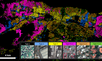
Settlement Characterization
Settlement Characterization
Exploiting overhead imagery to develop scalable ways to characterize socioeconomic neighborhoods for economic stimulus, unstructured settlement mapping, population distribution studies, and more.

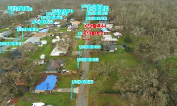
Automated Feature Extraction
Automated Feature Extraction
Employing machine learning, computer vision, and high-performance computing to automate the creation of foundational data layers for building footprints, road networks, solar panels, and more at scale.
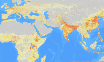
Population Dynamics
Population Dynamics
Applying Bayesian learning approaches to estimate building occupancy at varying times of day and night across a variety of sociocultural environments, improving urban planning, emergency management, and disaster response.
Gravity Mapping
Gravity Mapping
Adapting AI techniques to produce high-resolution gravity maps on a global scale to support navigation systems, early detection of potential earthquakes, and measurement of changes in water patterns
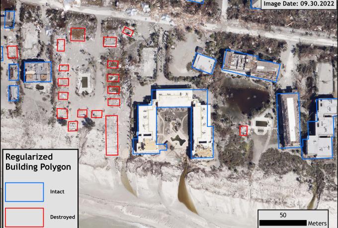
Keeping people safe

Contact

Dalton Lunga, Group Leader
View profile
Dalton Lunga, Group Leader