
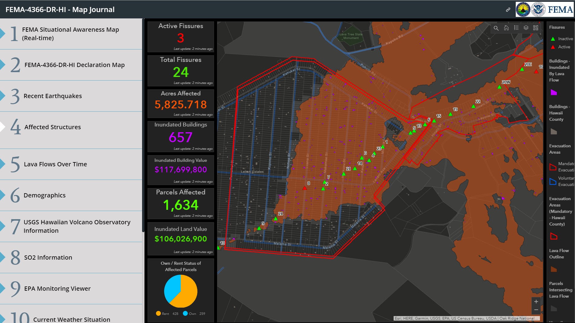
July 2, 2018—Geospatial data from Oak Ridge National Laboratory is supporting emergency response to destructive volcanic activity in Hawaii. Researchers provided the Federal Emergency Management Agency with information on buildings and structures that was rapidly extracted from satellite imagery using novel deep learning techniques. Ongoing eruptions from the Kilauea volcano since May have opened fissures of flowing lava across the Big Island, damaging more than 700 homes. Identifying and characterizing vulnerable and affected structures, such as residences, businesses, schools and hospitals, are major aspects of emergency response and post-impact damage assessments. “Our expertise with large datasets combined with high-performance computing resources gives us the ability to provide this information very quickly,” said ORNL’s Mark Tuttle. His team processed data focused near Kilauea in less than a day and all visible structures on the entire Island of Hawaii in two weeks.


