Download a PDF of the story here.
The geology along Ecuador’s Coca River is moving in fast-forward. In a scientific field where natural wonders form over millennia, but natural disasters occur in minutes, speed is less than desirable.
Over the last four years, the river and its surrounding area within the Amazon basin have experienced a lava dam collapse, 500 million tons of sediment displaced down the river, landslides and the formation of what some have dubbed the “Ecuadorian Grand Canyon.”
In the wake of these events, bridges and pipelines have collapsed, collapsing riverbanks have threatened homes and businesses, and Ecuadorian engineers feared the rapidly dropping headwaters of the river could take out a hydropower plant that provides electricity to one-third of the country.
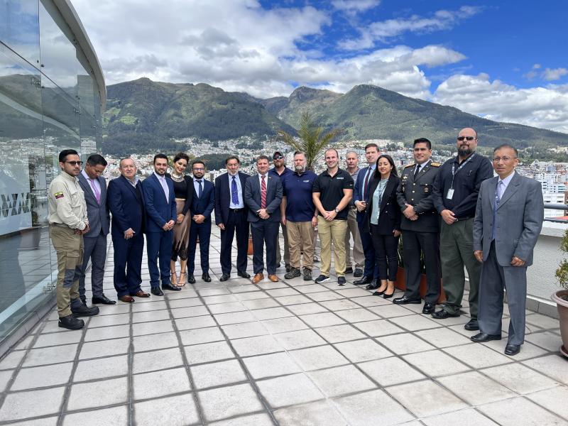
These impacts and threats brought together an international group of experts, including Matt Larson and Brandon Stockwell from the Autonomous Systems group at the Department of Energy’s Oak Ridge National Laboratory. Larson and Stockwell used drones to map a previously unstudied section of the Coca River. The team’s high-resolution visual, thermal and multispectral imagery will be used to update Ecuador's national maps and create better engineering models to mitigate the erosion.
To better understand the gravity of their mission, let’s rewind.
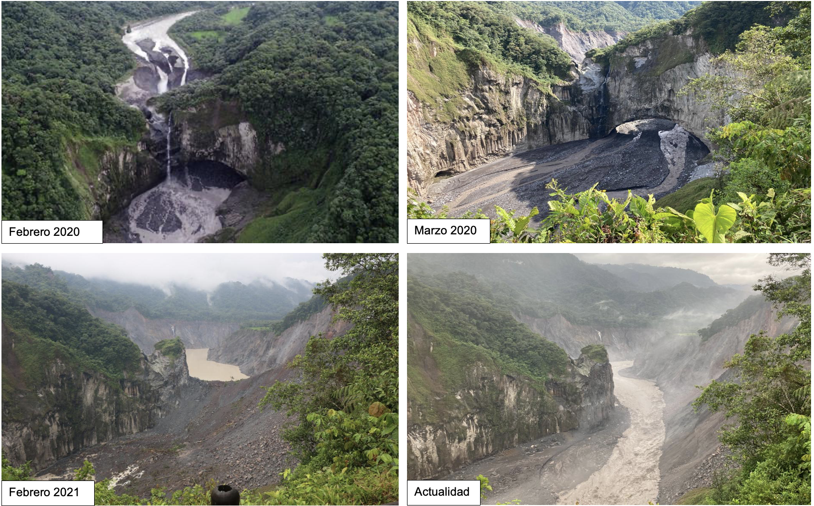
On Feb. 2, 2020, the San Rafael waterfall disappeared.
Journalists and geologists have used various words to describe what happened to Ecuador’s largest waterfall four years ago. Whether the natural wonder “failed,” “collapsed” or was “abandoned,” the singular phenomenon on the Coca River that day began a cascade of geographic events that continue to impact the country’s landscape, infrastructure and security.
Pedro Barrera Crespo, a hydraulic engineer and consultant for the Corporación Eléctrica del Ecuador, or CELEC, the country’s major electric utility, had no problem landing on a word for it — “alarming.”
What actually happened?
The San Rafael Waterfall was formed thousands of years ago when volcaniclastic debris from the nearby Reventador Volcano formed a natural lava dam in the Coca River. It was once the tallest waterfall in Ecuador, plummeting from a height of approximately 150 meters, or 490 feet, amidst dense tropical rainforest. The river flowed over the lava dam, through the waterfall into a basin from where it continued another 400 miles before meeting with the Amazon River.
Just upstream of the lava dam, a sinkhole formed in the riverbed. On Feb. 2, 2020, the sinkhole roof collapsed, dropping the river flow below the lava dam rather than over it.
The river continued to flow, but one of Ecuador’s greatest tourist attractions was lost forever.

The losses would continue to compound in the following months as the effects of this unique event unfolded. It’s easiest to explore the waterfall collapse fallout in two sections: upstream and downstream of the lava dam.
Upstream: Erosion, headcut and a hydropower threat
The sinkhole collapse left behind a sharp change in the riverbed slope, known as a headcut, just upstream of the lava dam. Freshly exposed riverbed material at a headcut is unstable, causing rock and soil to erode in the opposite direction of water flow. In the first 18 months following the waterfall event, the Coca River’s headcut regressed 12 kilometers, just over 7.4 miles, upstream as the water washed away the earth beneath it.
If the erosion had continued at this rate, Ecuador’s largest hydropower plant, located just 19 kilometers, or 11.8 miles, upstream of the waterfall, would likely have lost operation. The Coca Codo Sinclair Hydropower Facility supplies 26% of the country’s electricity.
Pablo Espinoza Girón, who leads the CELEC subcommission on the Coca River, said CELEC initially launched a study after the sinkhole collapse to understand the near-future implications for the hydropower plant.
“It was really a big warning for CELEC after that study because the results were alarming,” Girón said. “The potential implications were really dire for the plant.”
The implications being: If the river headcut were to erode its way upstream to the hydropower plant, the river would undermine the plant’s water intake. Without water, the plant can’t generate electricity, resulting in massive consequences for Ecuador’s people and commerce.
“It would be the U.S. equivalent of a power failure encompassing all the East Coast and some adjacent states,” ORNL’s Larson said.
Luckily, the headcut erosion slowed because of a combination of more stable riverbed materials closer to the hydropower plant and unusually dry river basin conditions since 2022. Still, erosion is worrisome for the country’s power supply as well as the surrounding landscape and infrastructure. The threat of collapse remains ever present as the river continues to flow.

Calling in reinforcements
With a two-pronged predicament threatening a major utility source, in addition to infrastructure and natural resources, the Ecuadorian government and the U.S. Ambassador to Ecuador called for help. Reinforcements included McConnell’s USACE team as well as experts from other national organizations such as the National Geospatial-Intelligence Agency, or NGA, to help mitigate the effects of this unique phenomenon. Additionally, the U.S. Geological Survey started helping develop a sediment monitoring plan to better characterize the soils in the area, and the U.S. Department of Agriculture conducted soil jet testing to determine soil erodibility.

“Our mission is focused on projects to control this erosion profile and stabilize it before it reaches the intake. We’re helping Ecuador monitor the downstream sediment as it progresses to determine, not so much if, but when they need to do a massive project to relocate the outlet structure further downstream,” McConnell said.
The Ambassador also made a special request for ORNL’s Larson and Stockwell to join the effort. Together, they brought to the mission previous experience, advanced skills and expertise in conducting remote operations. And the drones.
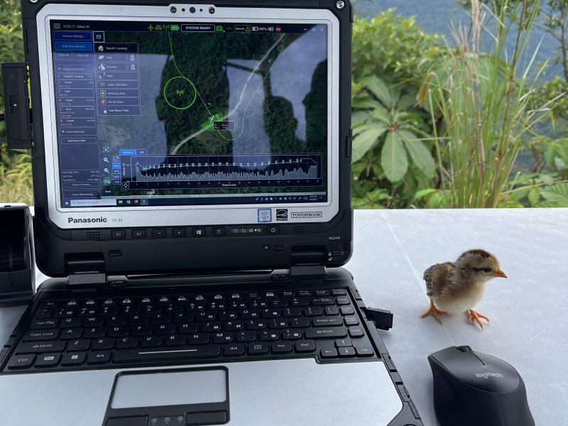
“It's over 1000-foot cliff down to the river in some areas, Larson said. “You just can't go and see what's happening. The only way to really do this is by drones.”
Larson is a research scientist in ORNL’s Autonomous Systems group with a background in geology and geospatial technology. In fact, Larson said while in graduate school he used the same drone model they took down to Ecuador to map river sediment. In other words, he was well suited for the job.
“This was right up my alley,” Larson said. “I never thought I would map sediment again in my research career, but here it is.”
The mapping is only one part of the job — Larson also helped process all the data the drones collected using ORNL’s high-performance computing resources. Translated and compiled, these data were used by CELEC to create models for mitigating the effects of the natural disaster on the Coca River and Ecuador’s infrastructure. The Ecuadorian government, USACE and NGA had done some initial surveying after the San Rafael waterfall collapse, but ORNL’s capabilities in the field and in the lab brought unmatched capabilities to catch up with Mother Nature.

“Data is king,” USACE’s McConnell said. “The numerical modeling and computer modeling to predict these erosion and sediment timelines is where Oak Ridge has become a very key player for us.”
While Larson brought the science and data processing background to the mission, he wasn't used to operating in remote environments. Enter Stockwell, an autonomous systems specialist at ORNL and US Marine Corps pilot. A complement to Larson, he’s well versed in operating drones and brought his own set of skills to the Coca River team in November 2023.
“As far as deployments and austere environments, that’s nothing new for me,” Stockwell said. “I’ve done a lot of deployments so it’s almost second nature to go out on expeditionary operations.”

Though the team had the right people in place, their work was cut out for them:
Mapping 100 kilometers of a river in 15 days with two drones and zero existing maps was no small feat.
The constant cloud cover over the Coca River is so thick, no helpful satellite imagery existed. The unyielding vegetation in the Amazon basin also made map-making seemingly impossible.
“It was a big mission set that Matt agreed to as far as the amount of mapping we were going to do with drones ... in two weeks,” Stockwell said. “The maps we were using to plan out missions were just clouds, or it was such old imagery it was like guesstimating where it was safe to fly.”
These conditions made drones mission-critical: They could fly under the clouds and launch vertically, giving the team flexibility amid the rough landscape. With a time-limited schedule, the team plotted out the kilometers they aimed to map each day, with some flexibility for the conditions.
“It’s always cloudy. It's always raining. Satellite imagery isn't good,” Larson said. “Drones are the only way to map this area.”
Shellenberger acknowledged this as well, noting that although they had the right equipment, Mother Nature brings her own agenda.
“It’s one of the most terrain- and weather-restricted environments I’ve ever been in,” Shellenberger said. “We had to build that into our timeline.”
Shellenberger added, the team also had to consider “Murphy” in their planning — a military term that harkens back to Murphy’s Law, which states anything that could go wrong will go wrong. And the team certainly encountered Murphy during the mission.

“You have to give Murphy his due”
While the unpredictable weather was a known variable, factors such as magnetic rocks presented unexpected challenges.
“You have to give Murphy his due,” Shellenberger said. “You can plan out and think of everything that could go wrong and have all these contingencies built into your plan, but there's this one thing that you had no control over and that can throw a kink in what you're trying to accomplish.”
Iron-rich rocks and sediment from volcanoes in the area littered the ground where the team needed to launch their drones. In addition, the magnetic quality interfered with the compasses on the drones, making launches a challenge.
“We’d set it on the ground and get an error,” Larson said. “We had to get creative on how to launch the drones.”
Larson and Stockwell described launching drones off stacked equipment cases and even their own hands.
Depending on the kindness of strangers
The team relied on help from Ecuador’s civilians as well. At times, the only places to launch were in privately owned fields or backyards. In these cases, CELEC representatives assisted by knocking on doors and speaking with people about the mission. Most of the community had no problem letting the team launch drones on their property.
Larson said people were not only understanding but welcoming. He grinned as he retold a particular story that highlighted this hospitality.
One day they found the perfect launch location at a school soccer field that overlooked 10-15 kilometers of the river they needed to map. After speaking with several townspeople, Larson said the team found the school principal’s house. They knocked on the door and asked permission to access the school grounds for launching drones.
The principal obliged. She sent her elementary-aged son to unlock the school gate. He hopped on his scooter and led the team’s truck to the school a few hundred meters away.

“That was a big, critical moment for us because if we didn't have access to that school, we would have struggled to find a good spot to launch,” Larson said. “The Ecuadorian people are so nice, and they understand what's happening down there.”
Landslides caused by river erosion and sedimentation were taking out the village’s roads along the river. Many used public transportation to commute to Quito, the country’s capital, for work. Others relied on the main road for transporting goods in and out of the village. Larson said if a particular bridge along the main road were to be undercut by the landslides, it would take an additional 10 hours to drive from the village to the capital.
Before Larson and Stockwell visited Ecuador, CELEC teams collected 10 to 20 kilometers of topographic information about every two months using basic drones and technology. ORNL’s team was able to accomplish in two weeks what previously may have taken eight months or longer.
Larson helped transform the drone maps into centimeter-resolution 2D and 3D models which are now being used to update the national maps of Ecuador, and to make better engineering models for the CELEC and the Army Corps of Engineers.
These models will help CELEC and their partners to outpace the erosion and sedimentation rates.
“It will really help them understand spots with a high potential for a landslide,” Larson said. “But also, they can look at, ‘okay if we do need to rebuild a bridge, where can we rebuild it?’ When we say, ‘kilometer 60,’ we know exactly where that is.”
McConnell said the team will first stabilize the erosion zone upstream of the former waterfall location in Spring of 2024. Then, he said, attention will turn to curbing the effects of the sediment load moving downstream.
“It's professionally exhilarating to work together to find a solution,” McConnell said. “You know you're charging into the great unknown — there's no road map for this.”

Espinoza Girón said, after looking at the models, the group is considering several options for sedimentation mitigation, including a diversion tunnel that would bring the hydropower plant outlet structure further downstream to avoid being buried in sediment. Another option he mentioned was creating artificial knickpoints, or sharp drops, in the riverbed, which would recreate how a river might form naturally and slow the erosion from the flowing sediment.
The chosen path could be a bellwether for future geology events of this sort. Barrera Crespo added that the speed at which the Coca River erosion and sedimentation progressed created a unique case study for the hydrogeology field. He hopes it will highlight the need for proper sediment management as new dams are built, now that the effects can be seen over months instead of the normal decades it takes for a riverbed to settle and erode.
“Sediment transport-related problems in rivers are not so easy to see in normal timescales,” Barrera Crespo said. “This is basically a once-in-a-lifetime opportunity we have to tackle this problem. With the help of world-renowned expertise, this has been a valuable opportunity for everyone.”

For Larson, the most important part of the mission is the ability to help Ecuador's people and their land. But it's also a watershed moment for his career.
“Meeting all the people down there and seeing the impact that we could provide are definitely going to be among the highlights of my career,” Larson said. “I’ll remember this for the rest of my life.”

Credits
Principal Investigator: Matthew Larson
Story by: Audrey Carson
Animation: Jacquelyn DeMink
Photography: Matthew Larson, Brandon Stockwell
Drone Videography: Brandon Stockwell