Since 2012, Oak Ridge National Laboratory’s Stan Wullschleger has served as director and principal investigator for the Department of Energy’s Next-Generation Ecosystem Experiments Arctic project. Wullschleger leads a team of 140 scientists from 4 national laboratories and several universities as part of the project, which targets a better predictive understanding of future climate in the Arctic and around the world.
Researchers conduct extensive fieldwork in remote parts of Alaska, gathering data to advance Earth system models that predict how thawing permafrost in a warming Arctic will affect regional and global climate systems.
Here is a behind-the-scenes peek at how scientists conduct field work in the Arctic, as told by Wullschleger on a recent 1-week trip to Alaska.
Friday, April 1
It’s been exciting to be back in the field and to work with such amazing colleagues from ORNL, Los Alamos National Laboratory, Lawrence Berkeley National Laboratory, and the University of Alaska Fairbanks. Among the seven of us working together each day, we have three early career researchers joining us from Los Alamos. They were full of questions as we made the 35-mile journey to our field site along the Sinuk River via helicopter. It’s been fun sharing in their excitement.
Saturday, April 2
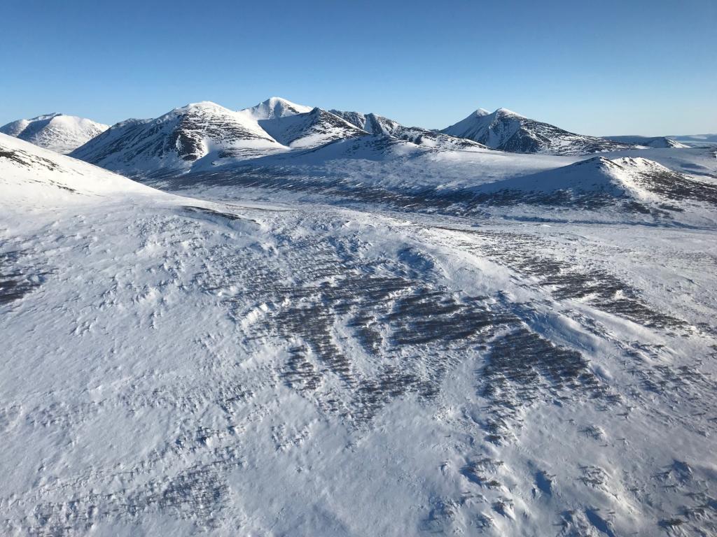
One of the nice things about commuting to our research site every day is the sights, sounds, and scenery—the snow-covered landscapes go on for what seems like forever, the whirl of the rotors, the downwash and blowing snow from the blades, and then the overwhelming silence as the helicopter departs in the distance.
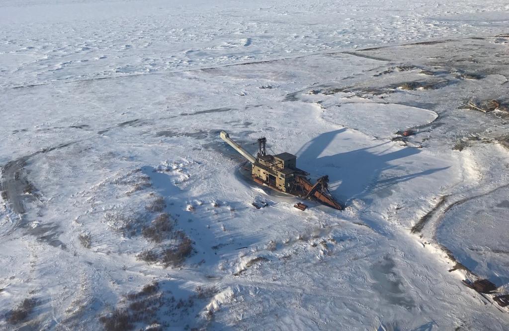
Yesterday, we were fortunate to fly along the Bering Sea coast and then turn inland toward our field site along the Sinuk River. We passed over a bucket dredge from the early 1900s. It was used to mine gold from shallow ponds, rivers, and lakes. These huge machines, two or three of which are in the Nome area, used a continuous chain of buckets to dig gravel and take it aboard the floating barge. The gold was separated through a sophisticated process. Although dredges are seldom used today, miners in and around Nome are still finding gold on land, along the black sandy beaches, and in the Bering Sea.
Monday, April 4
Our helicopter commutes now have a daily rhythm to them. Helmets on, radio check, check, and “Tower, this is N845 Bravo Hotel requesting clearance to the northwest.” The tower’s response is almost immediate: “N845 Bravo Hotel, you are cleared for takeoff. No incoming aircraft, skies are clear with winds light out of the west.” It’s the familiar sound of science and safety in western Alaska.
The first chapter of our field work focused on the coastal plain, and the story now unfolds inland to the more mountainous terrain outside Nome along the Kougarok Road. This field site, a much smaller catchment than the Teller site, is located 65 miles from Nome and just north of the Kigluaik Mountains. Here, the village of Mary’s Igloo thrived prior to the influenza outbreak in 1918. Mary’s Igloo is now quiet, and their proud elders graciously grant us a permit each year to conduct our research on their native lands.

Tuesday, April 5
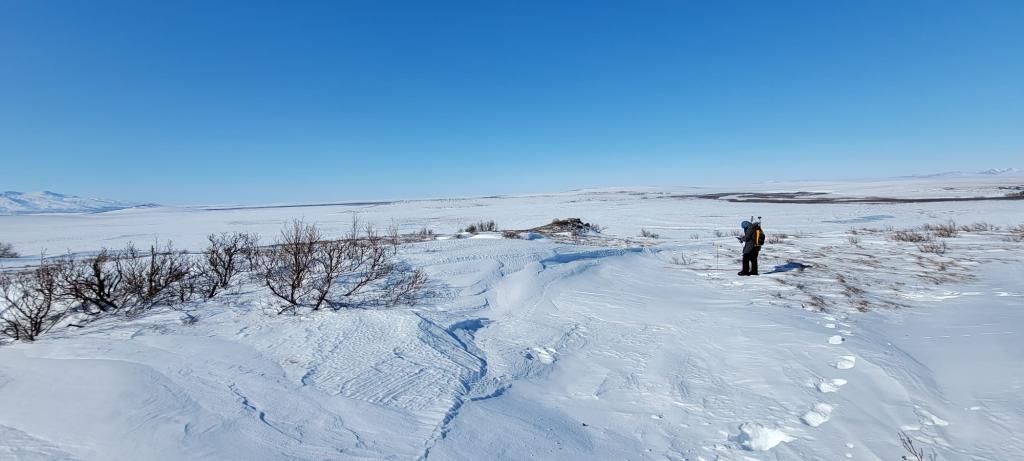
This morning, pilots from Bering Air brought our gear to the site, adjacent to Swan Lake, followed shortly thereafter by everyone from Los Alamos National Laboratory, the University of Alaska Fairbanks, and ORNL. Our first task was to separate equipment and supplies and prepare for the day ahead. This, too, has a daily rhythm with everyone knowing what they need for the task at hand. We transport most of our daily supplies in sleds that drag easily across the tundra.
Temperatures dropped overnight to 5°F, and we are hoping for clear skies and calm winds. Even a slight wind will cause the temperatures to plummet below −10°F. A safety check is made, thumbs up, and three teams spread out across the snow-covered landscape to begin the day. The sun is just peeking above the mountains.
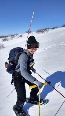
Today, I’m partnered with an enthusiastic graduate from the University of Maryland working as an intern at Los Alamos. Her boundless energy makes it hard to keep up as she quickly guides our steps across the tundra. Our goal today is 500 snow depth measurements at predetermined locations along several transects that crisscross the site. We have these stored in our tablet, and GPS makes it possible to navigate from one location to another. Once at a sample location, my task begins, measuring snow depth and snow density. The morning passes with my fingers only slightly feeling the chill. I’m noticing the wind more than earlier in the day.
Wednesday, April 6
It’s 1:30 p.m., the sun is high overhead, and my field partner for the day, Lauren Thomas, reminds me that we’ve completed roughly half of the daily goal. By now, the process of measuring snow depth and its properties is well established: locate, measure, and repeat. These measurements—more than 5,000 we hope to collect during this trip—will help us to develop a new snow depth and distribution model for DOE’s Energy Exascale Earth System Model. This is important not only for understanding water discharge to surrounding rivers and lakes once snow melts in the spring, but also the poorly characterized relationship among snow distribution, shrub cover, and permafrost temperatures. These are all interconnected, separate threads in the frozen fabric of the Arctic. If we improve our understanding, we’ll take a giant step toward more accurately simulating what controls the fate of these ice-rich landscapes in a warming future world.
The winds pick up as the afternoon progresses, blowing snow, and wind chill temperatures are well below zero. As often is the case, we postpone lunch until mid-afternoon, thinking that a sheltered location and a little sun will keep us warm.

Shelter is hard to find on the treeless tundra. Our pile of gear creates a wind break that provides some relief from the wind, but it’s still cold. It’s a moment to rest, tell stories, and enjoy one another’s company. Lauren’s water bottle is frozen. My bagel, which was soft this morning, is now like weathered leather. Oddly, science is about sharing moments like this. Yes, we collect hard drives full of data, analyze them in exquisite detail, and write countless manuscripts—these are important metrics of our research. However, the lifelong rewards are memories, stories, and friendships. We’re all making those today at −10°F.
After another 2 hours of work, we hear the whirl of the helicopter coming toward us in the distance. It’s a pleasant sound at the end of a long day! We wrap up our measurements, secure our gear, and make our way toward the helicopter. Our flight takes us across the mountains, following the still frozen waters of the Snake River, and into Nome, situated along Norton Sound and the Bering Sea beyond.
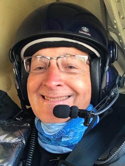
Our pilot, Michael, asks if we had a good day. Indeed, we have . . . and we’ll be back at it again tomorrow morning!
ORNL is managed by UT-Battelle for the Department of Energy's Office of Science, the single largest supporter of basic research in the physical sciences in the United States. DOE’s Office of Science is working to address some of the most pressing challenges of our time. For more information, please visit http://energy.gov/science.