OAK RIDGE, Tenn., Aug. 23, 2017 – New mapping methods developed by researchers at the Department of Energy’s Oak Ridge National Laboratory can help urban planners minimize the environmental impacts of cities’ water and energy demands on surrounding stream ecologies.
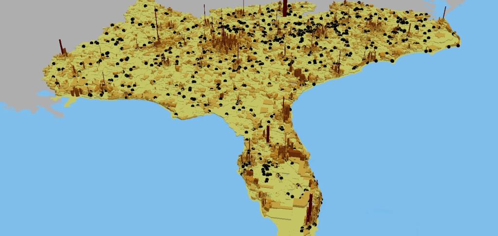
In an analysis published in Proceedings of the National Academy of Sciences, an ORNL-led team used high-resolution geospatial modeling to quantify the effects of land, energy, and water infrastructures on the nation’s rivers and streams. Using streamflow data from the U.S. Geological Survey, the researchers mapped changes to natural hydrology to assess how infrastructure development and competition over water resources affects the environment at a national scale. Their data-driven approach sheds light on the extent to which water resources and aquatic species are affected by urban infrastructures and could help cities curb their burden on regional ecosystems.
The results indicate that urban land transformation and electricity production together affect seven percent of U.S. streams, which influence habitats for more than 60 percent of all North American freshwater fish, mussel, and crayfish species.
Read more at - https://www.ornl.gov/news/high-resolution-modeling-assesses-impact-citi…