Global Leader in Remote Sensing
Global Leader in Remote Sensing
Ubiquitous spaceborne, airborne, and land-based remote sensors collect data used to characterize human populations, built environments, and natural resources. Data from remote-sensing technology is critical to national security, emergency management, natural resource monitoring, disease outbreak modeling, and many other research areas. Now, with significant advancements in emerging technologies, remotely sensed data are available at higher spatial, temporal, and spectral resolutions than ever before.
As a global leader in high-performance computing and geographic information science, Oak Ridge National Laboratory is at the forefront of research and development in data modeling, analysis, and visualization. As part of the integrated National Security Emerging Technologies Division, our team provides the expertise to develop algorithms that work across multimodal sensors and platforms to achieve new capabilities that advance the field of remote sensing.
Remote sensing refers to a suite of state-of-the-art tools and datasets that our group leverages with backgrounds in physics, oceanography, computer science, geology and more to address a broad portfolio of research topics related to national security, climate change, humanitarian missions, nuclear non-proliferation, disease modeling, and more.
Our group leverages a variety of commercial, open-source, and government-operated sensors to conduct basic research, advance the state-of-the-art, and deploy solutions across a variety of research and development sectors using remote sensing and geospatial analysis as tools for scientific discovery and operational solutions.

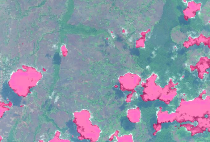
Monitoring and predicting disease outbreaks
Monitoring and predicting disease outbreaks
Identifying vector-borne disease outbreaks early enough to prevent or reduce their impact on DoD personnel and immediate beneficiaries is critical to health protection. Aedes vector RIsk mapping and Forecasting (ARIF) is a novel machine learning-based system that synthesizes decades of biosurveillance data, satellite climate measurements, and environmental data to develop real-time worldwide risk maps for an array of prominent and militarily-relevant vector-borne disease threats including dengue, chikungunya, and Zika.

Maritime surveillance
Maritime surveillance
Using temporal series of visible and radar satellite imagery, our Group works to track and surveil “dark vessels” under adverse conditions which are targets for therefore targeted for smuggling.

Emergency response
Emergency response
We help first responders prioritize where to send assistance as soon as possible. We develop technology and procedures that determine debris pile size and locations as well as edge computing on unmanned aerial systems.
Contact

Matt McCarthy, Remote Sensing Interim Group Leader