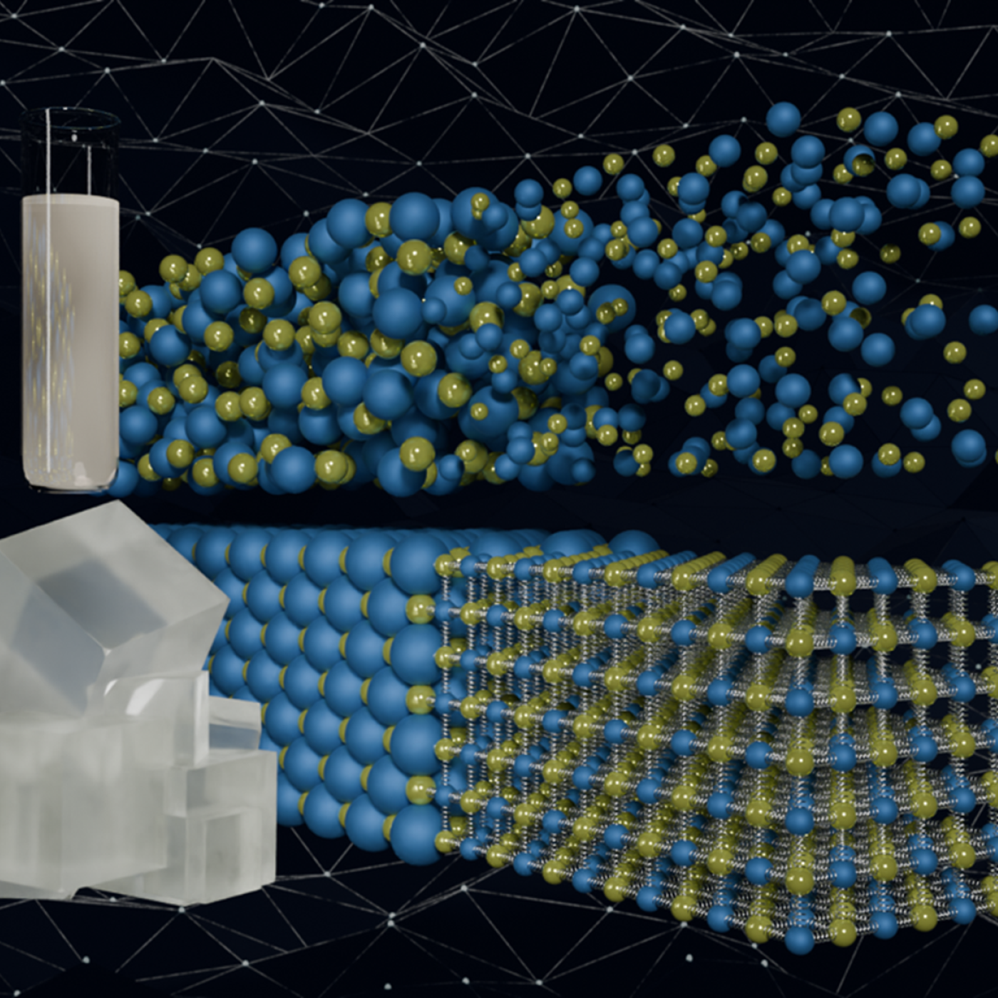
Quantum precision reached in modeling molten salt behavior

Researchers at Stanford University, the European Center for Medium-Range Weather Forecasts, or ECMWF, and ORNL used the lab’s Summit supercomputer to better understand atmospheric gravity waves, which influence significant weather patterns that are difficult to forecast.

During Hurricanes Helene and Milton, ORNL deployed drone teams and the Mapster platform to gather and share geospatial data, aiding recovery and damage assessments. ORNL's EAGLE-I platform tracked utility outages, helping prioritize recovery efforts. Drone data will train machine learning models for faster damage detection in future disasters.

Scientists conducted a groundbreaking study on the genetic data of over half a million U.S. veterans, using tools from the Oak Ridge National Laboratory to analyze 2,068 traits from the Million Veteran Program.

The US focuses on nuclear nonproliferation, and ORNL plays a key role in this mission. The lab conducts advanced research in uranium science, materials analysis and nuclear forensics to detect illicit nuclear activities. Using cutting-edge tools and operational systems, ORNL supports global efforts to reduce nuclear threats by uncovering the history of nuclear materials and providing solutions for uranium removal.


Maximiliano Ferrari, a researcher in the Grid Systems Architecture group at the Department of Energy’s Oak Ridge National Laboratory, has been elevated to prestigious senior membership in the Institute of Electrical and Electronics Engineers.

The National Center for Computational Sciences, located at the Department of Energy’s Oak Ridge National Laboratory, made a strong showing at computing conferences this fall. Staff from across the center participated in numerous workshops and invited speaking engagements.

Researchers are using machine learning to provide a more complete picture of building geometries that include building height to within three meters of accuracy. This model not only provides building height for any building in the world, but it will also feed into LandScan and other large government datasets for planning and response.

Scientists at the Department of Energy’s Oak Ridge National Laboratory recently demonstrated an autonomous robotic field monitoring, sampling and data-gathering system that could accelerate understanding of interactions among plants, soil and the environment.

A team of scientists with two Department of Energy Bioenergy Research Centers — the Center for Bioenergy Innovation at Oak Ridge National Laboratory and the Center for Advanced Bioenergy and Bioproducts Innovation at the University of Illinois Urbana-Champaign — identified a gene in a poplar tree that enhances photosynthesis and can boost tree height by about 30% in the field and by as much as 200% in the greenhouse.
