
Katy Bradford: Cassette approach offers compelling construction solution
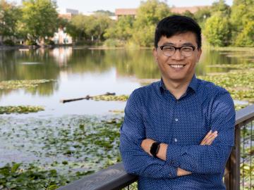
Daryl Yang is coupling his science and engineering expertise to devise new ways to measure significant changes going on in the Arctic, a region that’s warming nearly four times faster than other parts of the planet. The remote sensing technologies and modeling tools he develops and leverages for the Next-Generation Ecosystem Experiments in the Arctic project, or NGEE Arctic, help improve models of the ecosystem to better inform decision-making as the landscape changes.
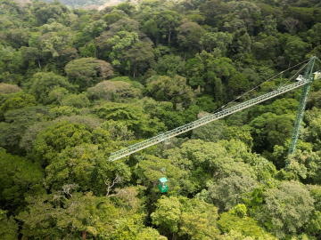
Scientists using high-resolution aerial scans and computational modeling concluded that wildfires, storms and selective logging have become key drivers behind rainforest carbon emissions, outpacing clear-cutting practices.

On Feb. 15, 2024, the one billionth item, also known as an “occupancy,” was scanned at the Port of Aqaba, Jordan, one of the early sites where radiation detection equipment was installed. This milestone shows the extent of countries committed to preventing the spread of radioactive material through the amount of data volunteered to ORNL for continuous improvement. As adversaries push the limits of smuggling dangerous material, this collaboration pushes back through science-backed analysis.
ORNL’s Joshua New was named the 2024 Researcher of the Year by R&D World magazine as part of its R&D 100 Professional Award winners.
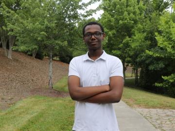
Elton Aba, an intern at the Department of Energy’s Oak Ridge National Laboratory, collaborated with researchers to explore an intriguing intersection: how biology can inform cybersecurity. Aba shared some of his findings on how biomimicry could help secure our nation’s critical infrastructure.
Mohamad Zineddin, a distinguished researcher in nuclear and radiological engineering, recently received the Roger Howsley Award for Excellence in Nuclear Security.
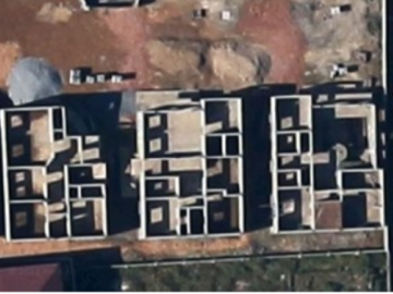
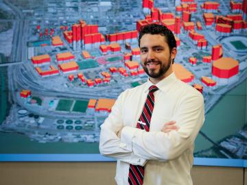
Researchers at ORNL are using satellite images of homes under construction to address gaps in census data, especially in areas like Sub-Saharan Africa. By analyzing these images, they estimate dwelling sizes and population densities where traditional data is sparse. This method improves population estimates and supports national security by enhancing emergency response capabilities.
Debjani Singh, a senior scientist at ORNL, leads the HydroSource project, which enhances hydropower research by making water data more accessible and useful. With a background in water resources, data science, and earth science, Singh applies innovative tools like AI to advance research. Her career, shaped by her early exposure to science in India, focuses on bridging research with practical applications.
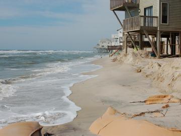
A study found that beaches with manmade fortifications recover more slowly from hurricanes than natural beaches, losing more sand and vegetation. The researchers used satellite images and light detection and ranging data, or LIDAR, to measure elevation changes and vegetation coverage. Changes in elevation showed how much sand was depleted during the storm and how much sand returned throughout the following year.
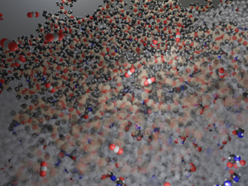
Researchers at ORNL have demonstrated that small molecular tweaks to surfaces can improve absorption technology for direct air capture of carbon dioxide. The team added a charged polymer layer to an amino acid solution, and then, through spectroscopy and simulation, found that the charged layer can hold amino acids at its surface.