


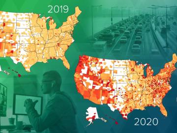
Researchers at Oak Ridge National Laboratory have empirically quantified the shifts in routine daytime activities, such as getting a morning coffee or takeaway dinner, following safer at home orders during the early days of the COVID-19 pandemic.
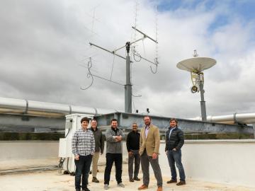
Oak Ridge National Laboratory is debuting a small satellite ground station that uses high-performance computing to support automated detection of changes to Earth’s landscape.

A research team from Oak Ridge National Laboratory has identified and improved the usability of data that can help accelerate innovation for the growing bioeconomy.
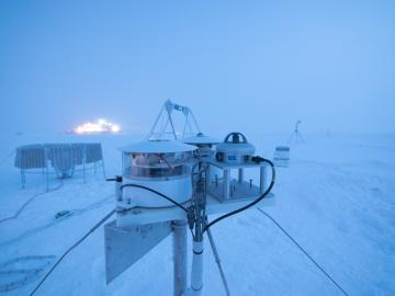
Researchers at Oak Ridge National Laboratory were part of an international team that collected a treasure trove of data measuring precipitation, air particles, cloud patterns and the exchange of energy between the atmosphere and the sea ice.
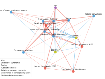
Scientists have tapped the immense power of the Summit supercomputer at Oak Ridge National Laboratory to comb through millions of medical journal articles to identify potential vaccines, drugs and effective measures that could suppress or stop the

A novel approach developed by scientists at ORNL can scan massive datasets of large-scale satellite images to more accurately map infrastructure – such as buildings and roads – in hours versus days.