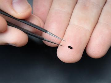
![White car (Porsche Taycan) with the hood popped is inside the building with an american flag on the wall.](/sites/default/files/styles/featured_square_large/public/2024-06/2024-P09317.jpg?h=8f9cfe54&itok=m6sQhZRq)
Filter News
Area of Research
- Advanced Manufacturing (2)
- Biology and Environment (5)
- Clean Energy (23)
- Climate and Environmental Systems (2)
- Computer Science (1)
- Fusion and Fission (2)
- Fusion Energy (2)
- Isotopes (1)
- Materials (11)
- Materials for Computing (1)
- National Security (4)
- Neutron Science (3)
- Nuclear Science and Technology (9)
- Nuclear Systems Modeling, Simulation and Validation (1)
- Supercomputing (11)
News Type
News Topics
- (-) Artificial Intelligence (4)
- (-) Big Data (3)
- (-) Bioenergy (7)
- (-) Cybersecurity (1)
- (-) Environment (18)
- (-) Grid (5)
- (-) Machine Learning (6)
- (-) Microscopy (6)
- (-) Nuclear Energy (16)
- (-) Security (2)
- 3-D Printing/Advanced Manufacturing (17)
- Advanced Reactors (9)
- Biology (4)
- Biomedical (14)
- Biotechnology (1)
- Buildings (1)
- Chemical Sciences (5)
- Climate Change (9)
- Composites (1)
- Computer Science (21)
- Coronavirus (16)
- Critical Materials (2)
- Decarbonization (1)
- Energy Storage (16)
- Exascale Computing (1)
- Frontier (1)
- Fusion (6)
- High-Performance Computing (2)
- Isotopes (6)
- Materials (2)
- Materials Science (26)
- Mathematics (1)
- Molten Salt (2)
- Nanotechnology (14)
- National Security (2)
- Neutron Science (21)
- Physics (12)
- Polymers (6)
- Quantum Science (6)
- Space Exploration (1)
- Summit (12)
- Sustainable Energy (19)
- Transformational Challenge Reactor (2)
- Transportation (9)
Media Contacts
![A new computational approach by ORNL can more quickly scan large-scale satellite images, such as these of Puerto Rico, for more accurate mapping of complex infrastructure like buildings. Credit: Maxar Technologies and Dalton Lunga/Oak Ridge National Laboratory, U.S. Dept. of Energy](/sites/default/files/styles/list_page_thumbnail/public/2020-02/Puerto_Rico_Resflow9.png?h=a0a1befd&itok=5n2fss_e)
A novel approach developed by scientists at ORNL can scan massive datasets of large-scale satellite images to more accurately map infrastructure – such as buildings and roads – in hours versus days.
![Scanning probe microscopes use an atom-sharp tip—only a few nanometers thick—to image materials on a nanometer length scale. The probe tip, invisible to the eye, is attached to a cantilever (pictured) that moves across material surfaces like the tone arm on a record player. Credit: Genevieve Martin/Oak Ridge National Laboratory; U.S. Dept. of Energy.](/sites/default/files/styles/list_page_thumbnail/public/2020-01/2019-P15115.jpg?h=c6980913&itok=o69jyoNw)
Liam Collins was drawn to study physics to understand “hidden things” and honed his expertise in microscopy so that he could bring them to light.
![Dalton Lunga](/sites/default/files/styles/list_page_thumbnail/public/2020-01/Dalton_Lunga.jpg?h=4dcbbf6e&itok=0FQ-t5EF)
A typhoon strikes an island in the Pacific Ocean, downing power lines and cell towers. An earthquake hits a remote mountainous region, destroying structures and leaving no communication infrastructure behind.
![Smart Neighborhood homes](/sites/default/files/styles/list_page_thumbnail/public/2020-01/04.09.TD-SMartHome_0.jpg?h=5b5a5437&itok=22S5Tle1)
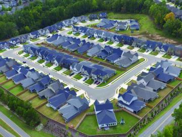
To better determine the potential energy cost savings among connected homes, researchers at Oak Ridge National Laboratory developed a computer simulation to more accurately compare energy use on similar weather days.