![This photo is of a male scientist sitting at a desk working with materials, wearing protective glasses.](/sites/default/files/styles/featured_square_large/public/2024-07/2023-P08173.jpg?h=c6980913&itok=LnJLvflD)
Filter News
Area of Research
- (-) National Security (17)
- (-) Neutron Science (19)
- Advanced Manufacturing (5)
- Biology and Environment (23)
- Clean Energy (42)
- Computational Biology (1)
- Computer Science (2)
- Electricity and Smart Grid (1)
- Functional Materials for Energy (1)
- Fusion and Fission (2)
- Fusion Energy (2)
- Isotopes (3)
- Materials (37)
- Materials for Computing (6)
- Nuclear Science and Technology (9)
- Quantum information Science (2)
- Supercomputing (49)
News Topics
- (-) 3-D Printing/Advanced Manufacturing (3)
- (-) Artificial Intelligence (7)
- (-) Big Data (5)
- (-) Biomedical (7)
- (-) Computer Science (18)
- (-) Nanotechnology (6)
- (-) Security (7)
- (-) Space Exploration (1)
- Advanced Reactors (1)
- Bioenergy (5)
- Biology (5)
- Biotechnology (1)
- Buildings (1)
- Chemical Sciences (2)
- Climate Change (5)
- Coronavirus (7)
- Cybersecurity (8)
- Decarbonization (2)
- Energy Storage (4)
- Environment (5)
- Exascale Computing (1)
- Frontier (2)
- Grid (4)
- High-Performance Computing (1)
- Machine Learning (6)
- Materials (4)
- Materials Science (11)
- Mathematics (1)
- Microscopy (1)
- National Security (15)
- Neutron Science (35)
- Nuclear Energy (2)
- Partnerships (1)
- Physics (4)
- Polymers (1)
- Quantum Science (4)
- Simulation (1)
- Summit (7)
- Sustainable Energy (3)
- Transportation (1)
Media Contacts
![A new computational approach by ORNL can more quickly scan large-scale satellite images, such as these of Puerto Rico, for more accurate mapping of complex infrastructure like buildings. Credit: Maxar Technologies and Dalton Lunga/Oak Ridge National Laboratory, U.S. Dept. of Energy](/sites/default/files/styles/list_page_thumbnail/public/2020-02/Puerto_Rico_Resflow9.png?h=a0a1befd&itok=5n2fss_e)
A novel approach developed by scientists at ORNL can scan massive datasets of large-scale satellite images to more accurately map infrastructure – such as buildings and roads – in hours versus days.
![Closely spaced hydrogen atoms could facilitate superconductivity in ambient conditions](/sites/default/files/styles/list_page_thumbnail/public/2020-02/Closely_spaced_hydrogen_atoms-correct.png?h=6a4c2577&itok=GBnxpWls)
An international team of researchers has discovered the hydrogen atoms in a metal hydride material are much more tightly spaced than had been predicted for decades — a feature that could possibly facilitate superconductivity at or near room temperature and pressure.
![Dalton Lunga](/sites/default/files/styles/list_page_thumbnail/public/2020-01/Dalton_Lunga.jpg?h=4dcbbf6e&itok=0FQ-t5EF)
A typhoon strikes an island in the Pacific Ocean, downing power lines and cell towers. An earthquake hits a remote mountainous region, destroying structures and leaving no communication infrastructure behind.
![Smart Neighborhood homes](/sites/default/files/styles/list_page_thumbnail/public/2020-01/04.09.TD-SMartHome_0.jpg?h=5b5a5437&itok=22S5Tle1)
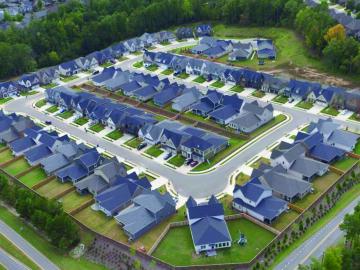
To better determine the potential energy cost savings among connected homes, researchers at Oak Ridge National Laboratory developed a computer simulation to more accurately compare energy use on similar weather days.