

ORNL scientists develop a sample holder that tumbles powdered photochemical materials within a neutron beamline — exposing more of the material to light for increased photo-activation and better photochemistry data capture.
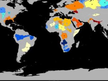
Groundwater withdrawals are expected to peak in about one-third of the world’s basins by 2050, potentially triggering significant trade and agriculture shifts, a new analysis finds.
ORNL climate modeling expertise contributed to a project that assessed global emissions of ammonia from croplands now and in a warmer future, while also identifying solutions tuned to local growing conditions.
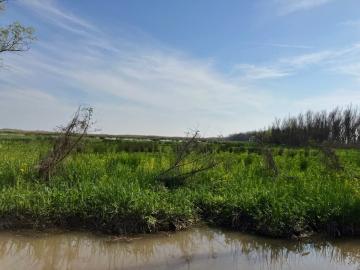
Scientists at the Department of Energy’s Oak Ridge National Laboratory are using a new modeling framework in conjunction with data collected from marshes in the Mississippi Delta to improve predictions of climate-warming methane and nitrous oxide.
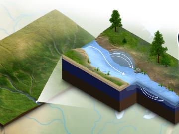
A new modeling capability developed at Oak Ridge National Laboratory incorporates important biogeochemical processes happening in river corridors for a clearer understanding of how water quality will be impacted by climate change, land use and
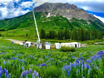
New data hosted through the Atmospheric Radiation Measurement Data Center at Oak Ridge National Laboratory will help improve models that predict climate change effects on the water supply in the Colorado River Basin.
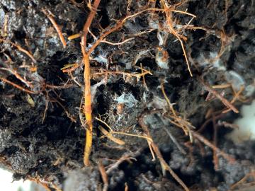
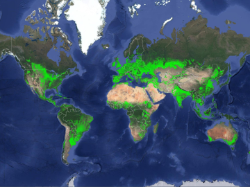
New data hosted by Oak Ridge National Laboratory is helping scientists around the world understand the secret lives of plant roots as well as their impact on the global carbon cycle and climate change.
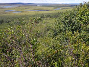
Scientists at Oak Ridge National Laboratory added new plant data to a computer model that simulates Arctic ecosystems, enabling it to better predict how vegetation in rapidly warming northern environments may respond to climate change.
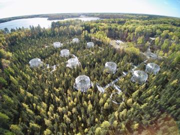
Scientists studying a unique whole-ecosystem warming experiment in the Minnesota peatlands found that microorganisms are increasing methane production faster than carbon dioxide production.
Researchers at Oak Ridge National Laboratory have identified a statistical relationship between the growth of cities and the spread of paved surfaces like roads and sidewalks. These impervious surfaces impede the flow of water into the ground, affecting the water cycle and, by extension, the climate.