LandScan Global depicts population distribution estimates across the planet. The darker orange and red colors above indicate higher population density. Credit: ORNL, U.S. Dept. of Energy

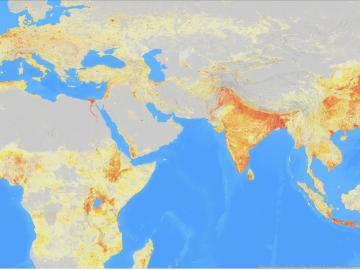
It’s a simple premise: To truly improve the health, safety, and security of human beings, you must first understand where those individuals are.

ORNL, VA and Harvard researchers developed a sparse matrix full of anonymized information on what is thought to be the largest cohort of healthcare data used for this type of research in the U.S. The matrix can be probed with different methods, such as KESER, to gain new insights into human health. Credit: Nathan Armistead/ORNL, U.S. Dept. of Energy

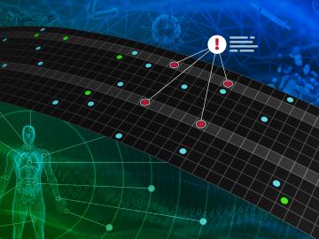
A team of researchers has developed a novel, machine learning–based  technique to explore and identify relationships among medical concepts using electronic health record data across multiple healthcare providers.

A zoomed in view of downtown Chattanooga’s sensors, which allowed the researchers to create building occupancy schedules that could enable improved energy efficiency and faster emergency responses. Credit: Andy Berres/ORNL, U.S. Dept. of Energy

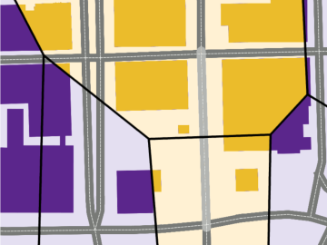
Every day, hundreds of thousands of commuters across the country travel from houses, apartments and other residential spaces to commercial buildings — from offices and schools to gyms and grocery stores.