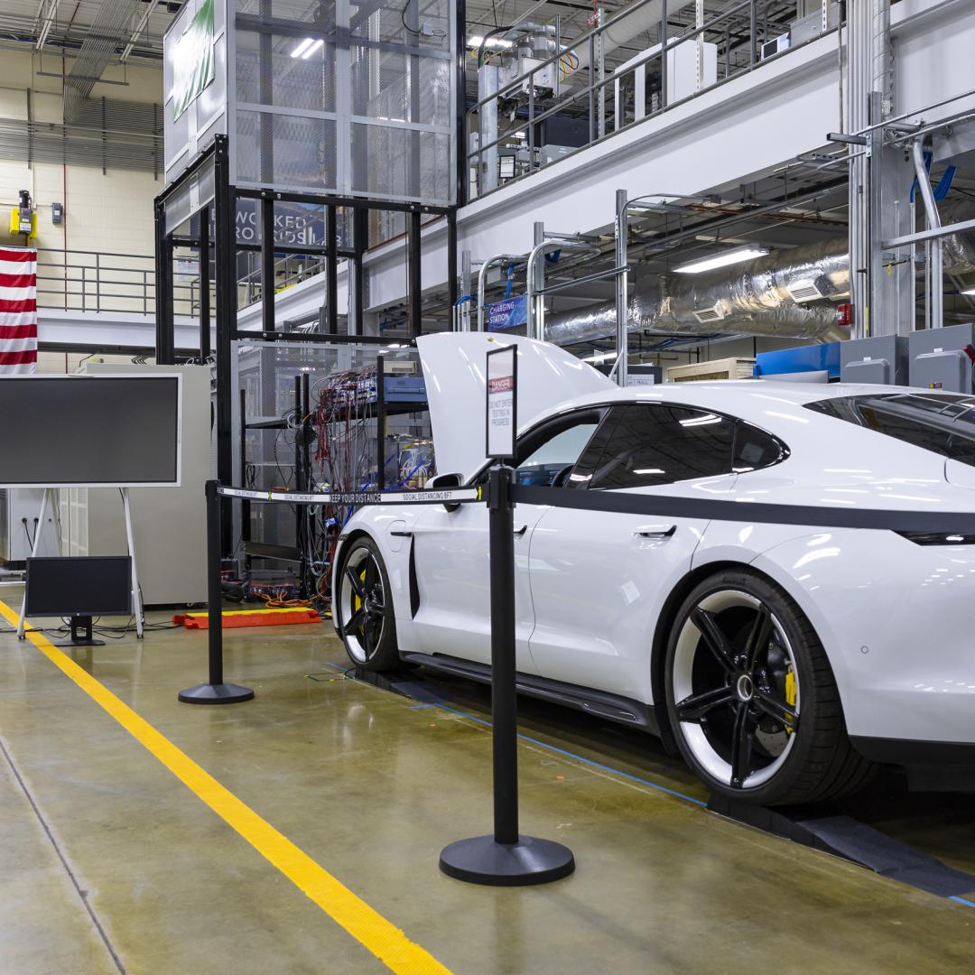
ORNL research scientist Christa Brelsford explained a mathematical framework she developed in 2018, which showed increased availability of infrastructure didn’t necessarily reduce inequality in its access. Credit: Carlos Jones/ORNL, U.S. Dept. of Energy

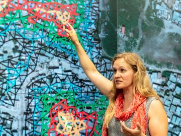
Unequal access to modern infrastructure is a feature of growing cities, according to a study published this week in the Proceedings of the National Academy of Sciences

ORNL scientists created a new microbial trait mapping process that improves on classical protoplast fusion techniques to identify the genes that trigger desirable genetic traits like improved biomass processing. Credit: Nathan Armistead/ORNL, U.S. Dept. of Energy. Reprinted with the permission of Oxford University Press, publisher of Nucleic Acids Research

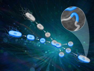
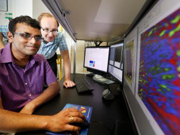
ORNL scientists had a problem mapping the genomes of bacteria to better understand the origins of their physical traits and improve their function for bioenergy production.

A zoomed in view of downtown Chattanooga’s sensors, which allowed the researchers to create building occupancy schedules that could enable improved energy efficiency and faster emergency responses. Credit: Andy Berres/ORNL, U.S. Dept. of Energy

Every day, hundreds of thousands of commuters across the country travel from houses, apartments and other residential spaces to commercial buildings — from offices and schools to gyms and grocery stores.

ORNL’s Sergei Kalinin and Rama Vasudevan (foreground) use scanning probe microscopy to study bulk ferroelectricity and surface electrochemistry -- and generate a lot of data. Credit: Jason Richards/ORNL, U.S. Dept. of Energy

At the Department of Energy’s Oak Ridge National Laboratory, scientists use artificial intelligence, or AI, to accelerate the discovery and development of materials for energy and information technologies.

Diverse evidence shows that plants and soil will likely capture and hold more carbon in response to increasing levels of carbon dioxide in the atmosphere, according to an analysis published by an international research team led by Oak Ridge National Laboratory.

Diverse evidence shows that plants and soil will likely capture and hold more carbon in response to increasing levels of carbon dioxide in the atmosphere, according to an analysis

Paul Abraham uses mass spectrometry to study proteins.

Systems biologist Paul Abraham uses his fascination with proteins, the molecular machines of nature, to explore new ways to engineer more productive ecosystems and hardier bioenergy crops.

ORNL’s Lab-on-a-crystal uses machine learning to correlate materials’ mechanical, optical and electrical responses to dynamic environments. Credit: Ilia Ivanov/ORNL, U.S. Dept. of Energy

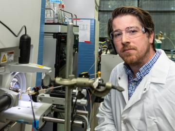
An all-in-one experimental platform developed at Oak Ridge National Laboratory’s Center for Nanophase Materials Sciences accelerates research on promising materials for future technologies.

The CrossVis application includes a parallel coordinates plot (left), a tiled image view (right) and other interactive data views. Credit: Chad Steed/Oak Ridge National Laboratory, U.S. Dept. of Energy

From materials science and earth system modeling to quantum information science and cybersecurity, experts in many fields run simulations and conduct experiments to collect the abundance of data necessary for scientific progress.

Pine trees in the Tuolumne Valley of Yosemite National Park show the effects of drought and fire. Credit: Anthony Walker/Oak Ridge National Laboratory, U.S. Dept. of Energy

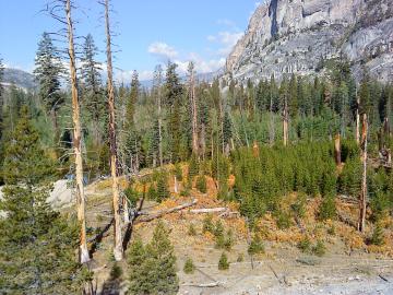
A multi-institutional research team found that changing environmental conditions are affecting forests around the globe, leading to increasing tree death and uncertainty about the ability of forests to recover.

A new computational approach by ORNL can more quickly scan large-scale satellite images, such as these of Puerto Rico, for more accurate mapping of complex infrastructure like buildings. Credit: Maxar Technologies and Dalton Lunga/Oak Ridge National Laboratory, U.S. Dept. of Energy

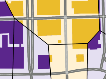
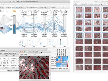
A novel approach developed by scientists at ORNL can scan massive datasets of large-scale satellite images to more accurately map infrastructure – such as buildings and roads – in hours versus days.