Scientists at ORNL completed a study of how well vegetation survived extreme heat events in both urban and rural communities across the country in recent years. The analysis informs pathways for climate mitigation, including ways to reduce the effect of urban heat islands.
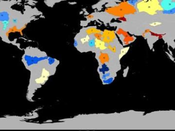
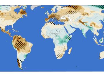
Groundwater withdrawals are expected to peak in about one-third of the world’s basins by 2050, potentially triggering significant trade and agriculture shifts, a new analysis finds.
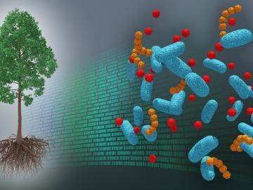
A first-ever dataset bridging molecular information about the poplar tree microbiome to ecosystem-level processes has been released by a team of DOE scientists led by ORNL. The project aims to inform research regarding how natural systems function, their vulnerability to a changing climate and ultimately how plants might be engineered for better performance as sources of bioenergy and natural carbon storage.
ORNL climate modeling expertise contributed to a project that assessed global emissions of ammonia from croplands now and in a warmer future, while also identifying solutions tuned to local growing conditions.
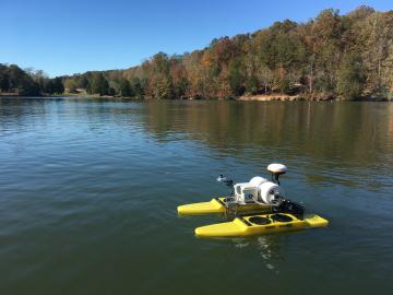
Measuring water quality throughout river networks with precision, speed and at lower cost than traditional methods is now possible with AquaBOT, an aquatic drone developed by Oak Ridge National Laboratory.
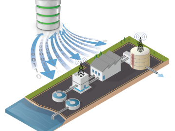
Oak Ridge National Laboratory scientists worked with the Colorado School of Mines and Baylor University to develop and test control methods for autonomous water treatment plants that use less energy and generate less waste.
A new analysis from Oak Ridge National Laboratory shows that intensified aridity, or drier atmospheric conditions, is caused by human-driven increases in greenhouse gas emissions. The findings point to an opportunity to address and potentially reverse the trend by reducing emissions.
An analysis by Oak Ridge National Laboratory shows that using less-profitable farmland to grow bioenergy crops such as switchgrass could fuel not only clean energy, but also gains in biodiversity.
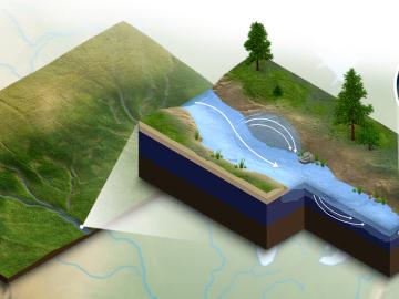
A new modeling capability developed at Oak Ridge National Laboratory incorporates important biogeochemical processes happening in river corridors for a clearer understanding of how water quality will be impacted by climate change, land use and
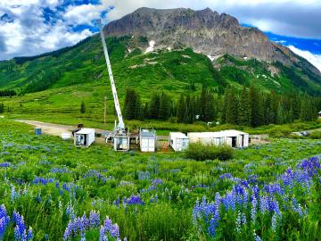
New data hosted through the Atmospheric Radiation Measurement Data Center at Oak Ridge National Laboratory will help improve models that predict climate change effects on the water supply in the Colorado River Basin.