Oak Ridge National Laboratory researchers have created a technology that more realistically emulates user activities to improve cyber testbeds and ultimately prevent cyberattacks.
To minimize potential damage from underground oil and gas leaks, Oak Ridge National Laboratory is co-developing a quantum sensing system to detect pipeline leaks more quickly.
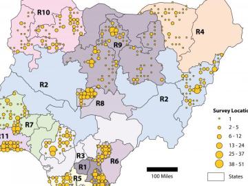
Oak Ridge National Laboratory scientists helped count the population of Nigeria – all without leaving the lab.
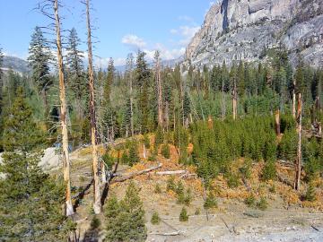
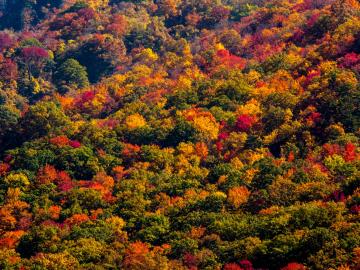
A multi-institutional research team found that changing environmental conditions are affecting forests around the globe, leading to increasing tree death and uncertainty about the ability of forests to recover.
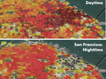
Oak Ridge National Laboratory’s high-resolution population distribution database, LandScan USA, became permanently available to researchers in time to aid the response to the novel coronavirus pandemic.

A novel approach developed by scientists at ORNL can scan massive datasets of large-scale satellite images to more accurately map infrastructure – such as buildings and roads – in hours versus days.
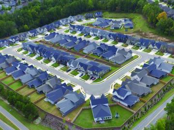
To better determine the potential energy cost savings among connected homes, researchers at Oak Ridge National Laboratory developed a computer simulation to more accurately compare energy use on similar weather days.
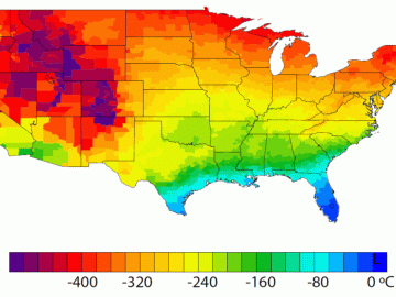
A detailed study by Oak Ridge National Laboratory estimated how much more—or less—energy United States residents might consume by 2050 relative to predicted shifts in seasonal weather patterns
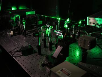
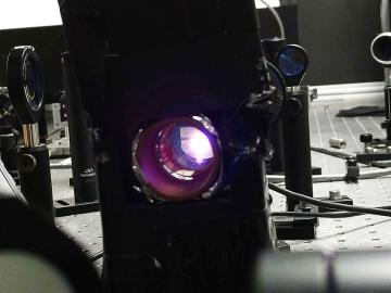
Scientists at Oak Ridge National Laboratory studying quantum communications have discovered a more practical way to share secret messages among three parties, which could ultimately lead to better cybersecurity for the electric grid