


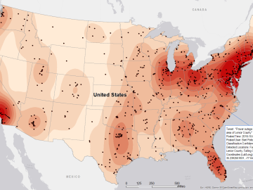
Gleaning valuable data from social platforms such as Twitter—particularly to map out critical location information during emergencies— has become more effective and efficient thanks to Oak Ridge National Laboratory.

The field of “Big Data” has exploded in the blink of an eye, growing exponentially into almost every branch of science in just a few decades. Sectors such as energy, manufacturing, healthcare and many others depend on scalable data processing and analysis for continued in...