ORNL researchers are establishing a digital thread of data, algorithms and workflows to produce a continuously updated model of earth systems.

Digital twins are exactly what they sound like: virtual models of physical reality that continuously update to reflect changes in the real world.


LandScan Global depicts population distribution estimates across the planet. The darker orange and red colors above indicate higher population density. Credit: ORNL, U.S. Dept. of Energy

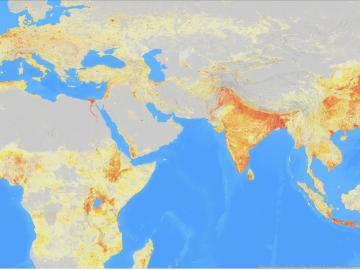
It’s a simple premise: To truly improve the health, safety, and security of human beings, you must first understand where those individuals are.

ORNL, VA and Harvard researchers developed a sparse matrix full of anonymized information on what is thought to be the largest cohort of healthcare data used for this type of research in the U.S. The matrix can be probed with different methods, such as KESER, to gain new insights into human health. Credit: Nathan Armistead/ORNL, U.S. Dept. of Energy

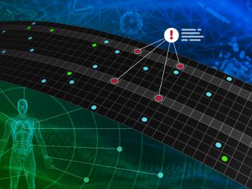
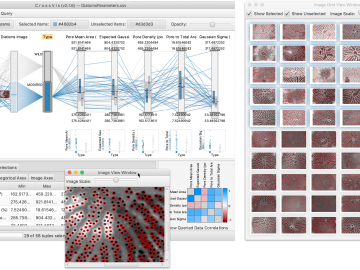
A team of researchers has developed a novel, machine learning–based  technique to explore and identify relationships among medical concepts using electronic health record data across multiple healthcare providers.

ORNL scientists used an electron beam for precision machining of nanoscale materials. Cubes were milled to change their shape and could also be removed from an array. Credit: Kevin Roccapriore/ORNL, U.S. Dept. of Energy

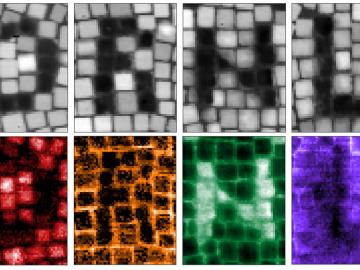
Drilling with the beam of an electron microscope, scientists at ORNL precisely machined tiny electrically conductive cubes that can interact with light and organized them in patterned structures that confine and relay light’s electromagnetic signal.

Researchers built optical tools called zero-mode waveguides, illustrated here, used to observe proteins that are implicated in human heart function. Credit: David S. White/University of Wisconsin-Madison

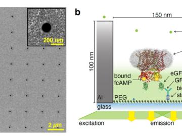
Researchers working with Oak Ridge National Laboratory developed a new method to observe how proteins, at the single-molecule level, bind with other molecules and more accurately pinpoint certain molecular behavior in complex

Parans Paranthaman, a researcher in the Chemical Sciences Division at ORNL, coordinated research efforts to study the filter efficiency of the N95 material. His published results represent one of the first studies on polypropylene as it relates to COVID-19. Credit: ORNL/U.S. Dept. of Energy

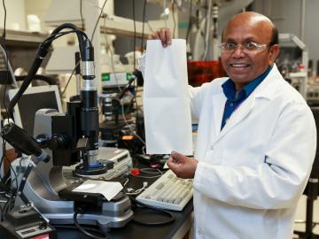
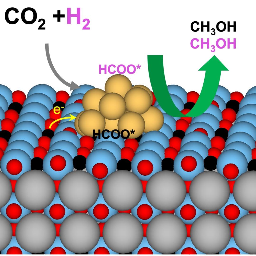
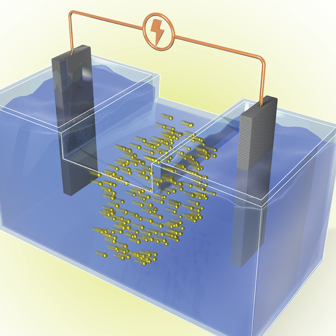
When COVID-19 was declared a pandemic in March 2020, Oak Ridge National Laboratory’s Parans Paranthaman suddenly found himself working from home like millions of others.

An international research team used scanning tunneling microscopy at ORNL to send and receive single molecules across a surface on an atomically precise track. Credit: Michelle Lehman/ORNL, U.S. Dept. of Energy

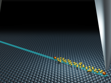
Oak Ridge National Laboratory’s Center for Nanophase Materials Sciences contributed to a groundbreaking experiment published in Science that tracks the real-time transport of individual molecules.

The CrossVis application includes a parallel coordinates plot (left), a tiled image view (right) and other interactive data views. Credit: Chad Steed/Oak Ridge National Laboratory, U.S. Dept. of Energy

From materials science and earth system modeling to quantum information science and cybersecurity, experts in many fields run simulations and conduct experiments to collect the abundance of data necessary for scientific progress.

A new computational approach by ORNL can more quickly scan large-scale satellite images, such as these of Puerto Rico, for more accurate mapping of complex infrastructure like buildings. Credit: Maxar Technologies and Dalton Lunga/Oak Ridge National Laboratory, U.S. Dept. of Energy

A novel approach developed by scientists at ORNL can scan massive datasets of large-scale satellite images to more accurately map infrastructure – such as buildings and roads – in hours versus days. 

As part of a preliminary study, ORNL scientists used critical location data collected from Twitter to map the location of certain power outages across the United States.

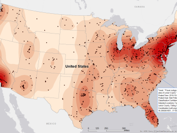
Gleaning valuable data from social platforms such as Twitter—particularly to map out critical location information during emergencies— has become more effective and efficient thanks to Oak Ridge National Laboratory.