


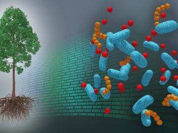
A first-ever dataset bridging molecular information about the poplar tree microbiome to ecosystem-level processes has been released by a team of DOE scientists led by ORNL. The project aims to inform research regarding how natural systems function, their vulnerability to a changing climate and ultimately how plants might be engineered for better performance as sources of bioenergy and natural carbon storage.
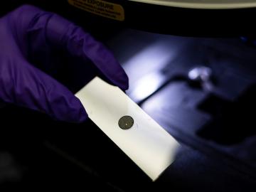
Nuclear nonproliferation scientists at ORNL have published the Compendium of Uranium Raman and Infrared Experimental Spectra, a public database and analysis of structure-spectral relationships for uranium minerals. This first-of-its-kind dataset and corresponding analysis fill a key gap in the existing body of knowledge for mineralogists and actinide scientists.

ORNL’s Assaf Anyamba has spent his career using satellite images to determine where extreme weather may lead to vector-borne disease outbreaks. His work has helped the U.S. government better prepare for outbreaks that happen during periods of extended weather events such as El Niño and La Niña, climate patterns in the Pacific Ocean that can affect weather worldwide.
ORNL took home the top honors in three categories at the second annual DOE Geospatial Science Poster competition, held on National GIS Day. For the second year in a row, DOE awarded ORNL top prize as Best Geospatial Program. Additionally, ORNL geospatial researchers took home first place prizes for their posters in the Best Departmental Element Alignment and Best Cartography categories.
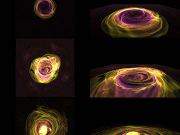
Astrophysicists at the State University of New York, Stony Brook and University of California, Berkeley, used the Oak Ridge Leadership Computing Facility’s Summit supercomputer to compare models of X-ray bursts in 2D and 3D.
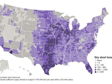
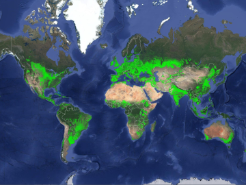
The United States could triple its current bioeconomy by producing more than 1 billion tons per year of plant-based biomass for renewable fuels, while meeting projected demands for food, feed, fiber, conventional forest products and exports, according to the DOE’s latest Billion-Ton Report led by ORNL.
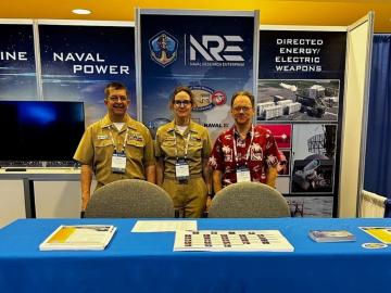
Lieutenant Commander Rich Harvey has spent the last three decades of his career serving his country. Harvey's efforts supporting the Office of Naval Research has earned him the 2023 Junior Scientist Officer of the Year award for coordination and computer modeling support for a project called TALISMAN, his leadership roles and other exemplary service markers.
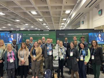
ORNL scientists and researchers attended the annual American Geophysical Union meeting and came away inspired for the year ahead in geospatial, earth and climate science.
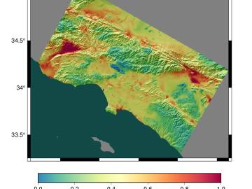
Researchers at the Statewide California Earthquake Center are unraveling the mysteries of earthquakes by using physics-based computational models running on high-performance computing systems at ORNL. The team’s findings will provide a better understanding of seismic hazards in the Golden State.
ORNL climate modeling expertise contributed to a project that assessed global emissions of ammonia from croplands now and in a warmer future, while also identifying solutions tuned to local growing conditions.